Despite the fact that HAB-2 was exempt from FAA regulations, I planned the launch with FAA requirements in mind.
- Launch site, flight path, and landing site was chosen to lie away from busy airspace
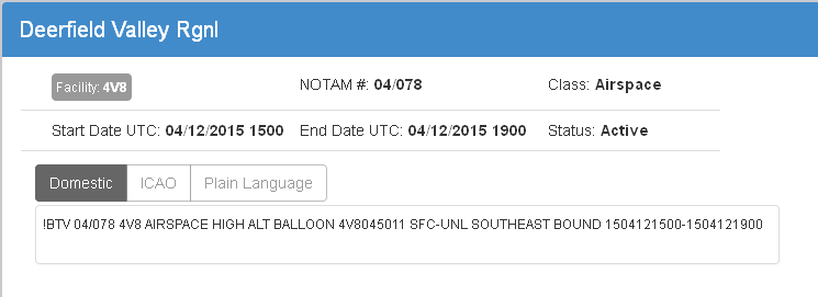
- Notice To Airment (NOTAM) was filed
- Boston Terminal Radar Approach Control (TRACON) was notified
- Boston Air Route Traffic Control Center (ARTCC) was notified
Choosing launch site
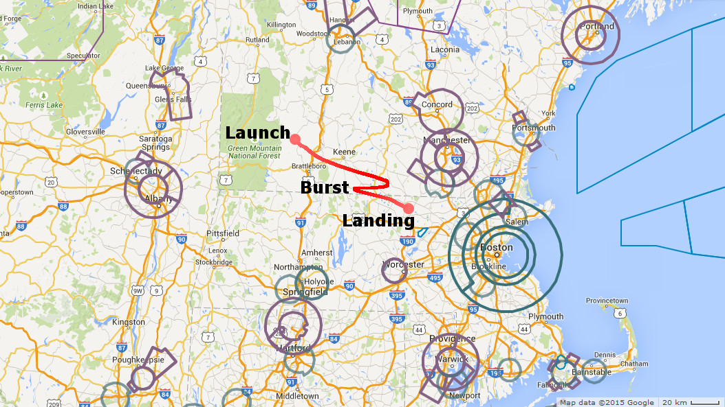
- Using Aviation Charts at FlightPlanner, I printed a map showing Class B, C, D, E airspace and all special use airspace (marked in circles on the map below)
- I studied wind patterns at WindFinder and Jet Stream maps
- Looked at flight predictions at CUSF flight predictor
Winds in Massachusetts blow predominantly east. We picked a launch site in Vermont, 100+ miles west from the coast, to keep balloon’s flight path away from major airports and Atlantic ocean.
Notifying FAA
First, I called Lockheed-Martin NOTAM filing service and filed a Notice To Airmen. It is easy to do, if you speak the right lingo – and if you don’t, have a look here and here.
- AIRSPACE HIGH ALT BALLOON
- 4V8045011 – 11 nautical miles from 4V8 airport at 45° radial (North-East)
- SFC-UNL – Surface to unlimited altitude (i.e. above 80,000 ft)
- SOUTHEAST BOUND – flight path direction
- 1504121500-1504121900 – 04/12/2015 from 15:00 UTC to 19:00 UTC time
Second, I called Boston Consolidated TRACON, which manages arrivals and departures from Boston Logan airport and dozens of smaller airports in the area.
Third, I called Boston ARTCC, which controls en-route air traffic.

